Longteng Bridge Photography: Angles, Light and Safe Viewpoints
The familiar view combines red-brick arches and forest. For more distinctive photos, include the broken edges, reinforcement details and the iron bridge behind—all from open paths without entering tracks or crossing barriers.
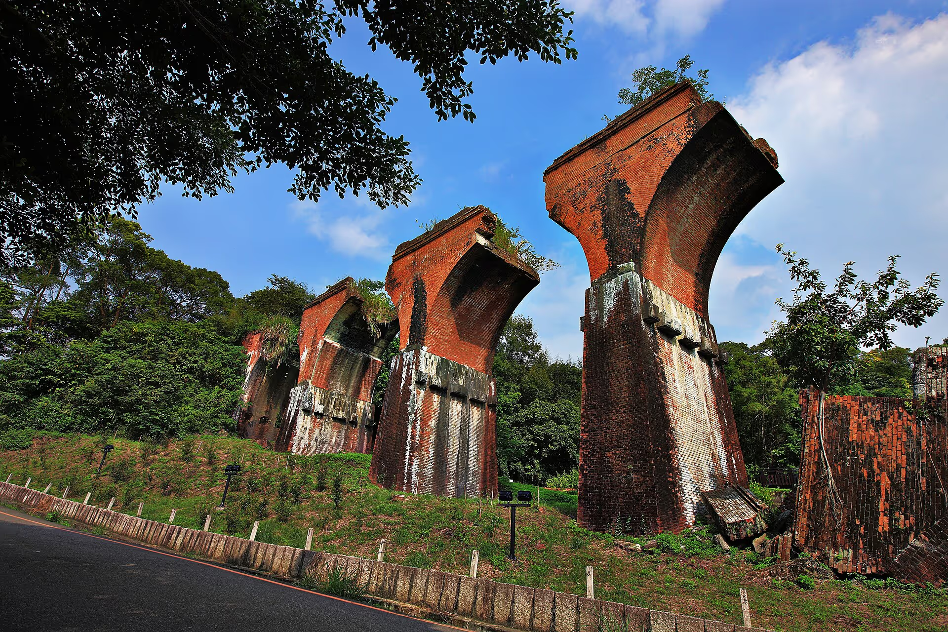
Classic composition
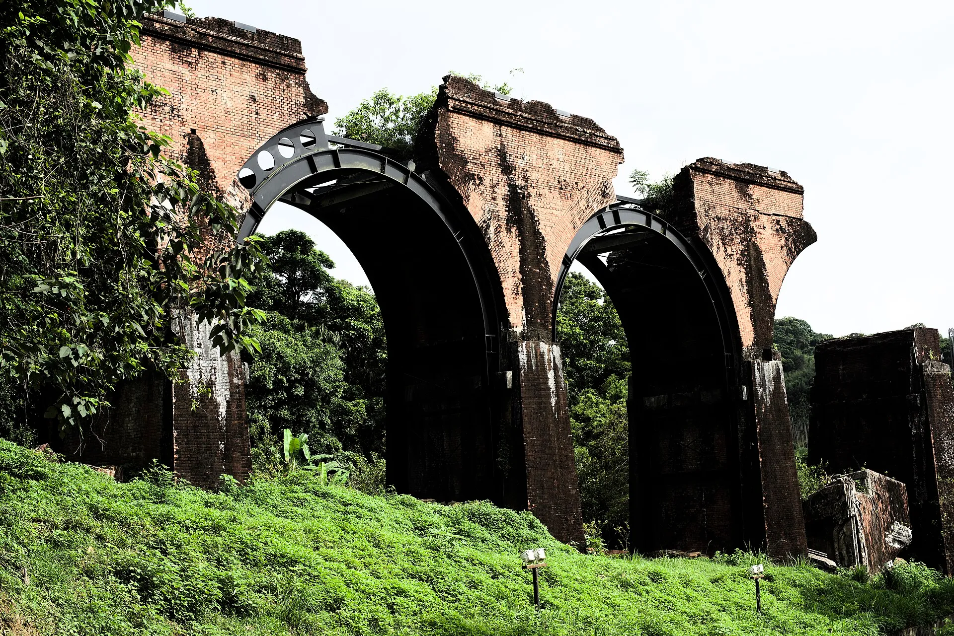
Frontal arches
Historical perspective
Brick and iron bridges together
Close-up details
Masonry and reinforcement
Safety
No trespassing or track access
Show the scale
People or trees can help convey the height of the piers.
Show the break
Side views more clearly reveal how the original bridge ends.
Show two eras
Frame the red-brick ruins together with the later steel bridge.
How do you take the classic front-facing photo?
From the main viewpoint, make the series of arches the subject and keep a little foreground and forest in the frame. A person helps viewers understand the scale; wait for a quieter moment if you prefer a clean composition.
Why do side views tell a stronger story?
From the side, the thickness of the arches, the location of the break and vegetation reclaiming the structure become more visible. This angle shows the actual historical condition rather than suggesting a symmetrical, intact bridge.
How can you photograph both bridges together?
Within the public viewing area, find a position showing both the brick arches and the steel girder bridge behind. The former belongs to the original 1907 bridge; the latter is the post-earthquake replacement. Their shared frame is a visual timeline.
What weather is best?
Overcast skies soften the contrast between brick and forest, revealing details more evenly. Sunshine creates stronger color and shadows. After rain, the brick may look darker, but surfaces can be slippery: safety takes priority over framing.
Three smartphone tips
- Clean the lens before switching to wide angle.
- Turn on the grid to keep tall piers from tilting dramatically.
- At one position, capture a wide scene, a medium view and a close-up of the brickwork.
Which locations are off limits?
Never enter railway tracks, cross barriers, climb the remains or stand in the roadway for an empty shot. Drone use must follow local and aviation rules and respect other visitors and heritage protection.
Explore the location from different angles
Plan your visit with Google Maps
Remains of Longteng Bridge (龍騰斷橋/魚藤坪斷橋)
Miaoli County Road 49, 367 Sanyi Township, Miaoli County, Taiwan
For official tourism information see Taiwan Tourism Administration (official tourism portal) . Map pins, reviews and business information change over time; follow road signs and on-site guidance for parking and walking routes.
Read next
- Seasons and climate Longteng Bridge Through the Seasons: Weather, Stream Conditions and Wildlife An overview of twelve months of typical temperatures, rain, humidity, creek conditions, wildlife and what to wear along the Old Mountain Line.
- Science and responsibility Why Did Longteng Bridge Break? Earthquake Engineering and Visitor Responsibility Understand how brick arches failed in the 1935 earthquake and why protecting the remains and their wildlife habitats matters.
- North and south remains North and South Longteng Broken Bridge: What Is the Difference? Understand the northern red-brick arches, the southern remains, where to photograph them and which rail-bike route connects the two.