Longteng Bridge Through the Seasons: Weather, Stream Conditions and Wildlife
In March the broken bridge can sit in mist; July brings dramatic light around afternoon storms; November often reveals crisp brick details. Combine long-term climate patterns, stream conditions and wildlife seasons to choose when to visit and how much flexibility to allow.
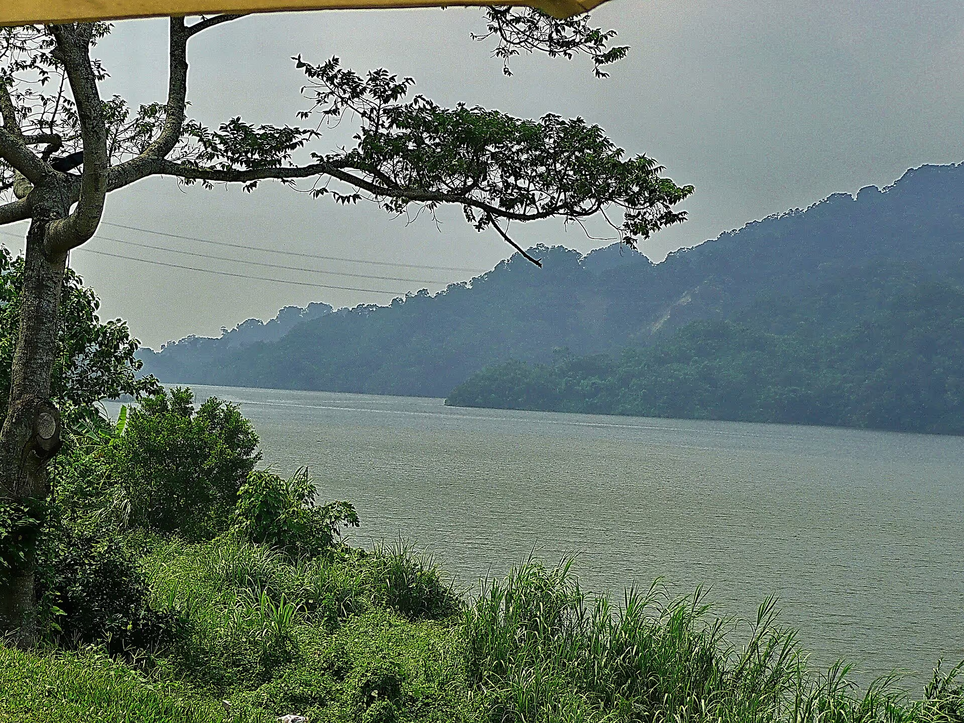
Elevation
Approximately 300–400 m
Climate
Humid low-elevation hills
Wettest periods
Plum rains and typhoons
Suggested months
October–November and March
Plum-rain season is wettest
Late May and June bring frequent rain; build an alternative into your day.
Autumn offers clearer views
Visibility often improves after October; November can be excellent for photography.
Winter brings mist
Cool, damp conditions can create layered light and shadow.
Why does Longteng feel different from Miaoli City?
Longteng Bridge sits in Longteng Village, Sanyi Township, at about 300–400 meters above sea level. This is not a high-mountain climate, but the low hills can differ noticeably from nearby plains:
- Slightly cooler temperatures: Typical annual temperatures may be around 1–2°C lower than Miaoli City, with a more noticeable winter chill.
- Higher humidity: Valley moisture lingers, particularly mornings and evenings, and brick surfaces and stone steps may stay damp.
- Faster changes: Afternoon convection and northeast monsoon conditions can transform clear weather into valley mist within a short period.
Yutengping Creek beneath the bridge belongs to the upstream catchment of Liyutan Reservoir. Water here is therefore both landscape and a protected resource, affecting what visitors may do.
A month-by-month climate overview
The following are approximate regional climate averages for seasonal planning, not predictions for a specific date. Consult a current forecast on the day of travel.
| Month | Avg. high | Avg. low | Rainy days | Rainfall | Humidity | Seasonal interest |
|---|---|---|---|---|---|---|
| Jan | 18°C | 13°C | 9 | Moderate | 80% | Clearer northeast-monsoon light and layered bridge silhouettes |
| Feb | 19°C | 14°C | 11 | Rather wet | 81% | Mountain cherry blossoms, mist and brick arches |
| Mar | 21°C | 16°C | 13 | Rather wet | 82% | Frequent mist and dramatic cloud-shrouded ruins |
| Apr | 25°C | 19°C | 13 | Rather wet | 80% | Start of tung-flower season and spring fireflies |
| May | 28°C | 22°C | 16 | Rather wet | 81% | White tung blossoms, humidity and active wildlife |
| Jun | 30°C | 24°C | 18 | Heaviest | 82% | Post-rain cloud banks, fuller creek and deep green hills |
| Jul | 32°C | 25°C | 15 | Rather wet | 78% | Contrasting light around afternoon storms; cooler early morning |
| Aug | 32°C | 25°C | 16 | Heaviest | 80% | Early morning, roughly 6–8 a.m., is the most comfortable outdoor window |
| Sep | 30°C | 24°C | 13 | Rather wet | 78% | Occasionally exceptional distant views between tropical-weather systems |
| Oct | 27°C | 22°C | 8 | Moderate | 75% | Clearer views after the wet season and more comfortable walking |
| Nov | 24°C | 18°C | 7 | Lower | 74% | Drier conditions, visibility and attractive photography light |
| Dec | 20°C | 14°C | 8 | Moderate | 78% | Low winter sunlight entering the arches at an angle |
Five seasonal strategies
Grouping months by weather pattern is often more useful than choosing a calendar date alone.
Spring (March–May): Mist and flowers
- What to see: March often brings valley mist. Tung blossoms start in April along the old railway, while some fireflies can be observed at night in April and May.
- Bring: Waterproof jacket, compact umbrella, shoes with grippy soles and a red-light flashlight for responsible firefly watching.
- Risks: Foggy driving, short heavy showers before plum-rain season and more active snakes and insects.
- Suggested time: 8–11 a.m., when the light is soft and mist may linger.
Plum rains (late May–June): Keep a backup plan
- What to see: More water in the valley and dramatic clouds after rain; Sanyi woodcarving museums can provide indoor alternatives.
- Bring: Raincoat rather than only an umbrella in hill winds, a backpack rain cover and dry spare socks or shoes.
- Risks: Flash rises in stream level, slippery mossy brick steps and rockfall from slopes.
- Suggested time: Short dry breaks, while checking radar and official warnings.
Summer (July–August): Go early, leave early
- What to see: Early mornings around 6–8 a.m. can be relatively cool and clear; towering clouds before afternoon storms are characteristic.
- Bring: Breathable clothing, sun hat, at least one liter of drinking water per person and compact rain protection.
- Risks: UV exposure, heat illness, afternoon lightning, typhoons and southwest monsoon rain.
- Suggested time: 6–10 a.m.; after about 11 a.m., consider indoor or shaded activities.
Autumn (September–November): Often the strongest all-round season
- What to see: Clearer valley views after the wet season; November is often favorable for photography and rail bike outings. Slanted autumn light emphasizes the brick arches.
- Bring: Light jacket for morning/evening changes, comfortable shoes and polarizing sunglasses if desired.
- Risks: Uncertain September typhoons, continued hornet activity in October–November and fast evening cooling.
- Suggested time: 9 a.m.–3 p.m. for a balance of light and temperature.
Winter (December–February): Cool dampness and dramatic light
- What to see: Low sun emphasizes brick texture; mist adds atmosphere, and mountain cherry blossoms may appear in February.
- Bring: Wind- and water-resistant outerwear, insulating layers, hat and gloves; check vehicle and fog lights.
- Risks: Dense fog while driving, persistent damp or cold surfaces and earlier darkness.
- Suggested time: 10 a.m.–2 p.m., avoiding the coldest, dampest hours.
Yutengping Creek: A changing mountain stream
The creek under the bridge is part of a water-resource catchment. Its appearance and flow respond rapidly to rain.
- Yutengping Creek is upstream of Liyutan Reservoir, within a protected water catchment. Swimming, barbecues and washing in the stream are prohibited.
- In drier periods the water can be clearer and rounded stones may show; after sustained rain it can turn cloudy and rise rapidly, sometimes within hours.
- Mountain streams may rise before rain reaches your exact location because of upstream rainfall. Watch water color and official warning signs.
- This is a natural creek, not a designated recreation pool. Observe it without entering the water, throwing rocks or introducing non-native species.
Safety signal: If water abruptly changes from clear to muddy, or you hear continuous rocks rolling upstream, leave the streambed immediately.
Wildlife calendar
| Period | What may be observed | Extra care? |
|---|---|---|
| Jan–Feb | Wintering and common birds; mountain cherry blossoms from February | Ordinary awareness |
| Mar–Apr | Crested serpent eagles calling and circling in thermals; tung blossoms in April | Ordinary awareness |
| Apr–May | Fireflies on dark woodland and creek edges after dusk | Yes: Use red light, keep distance, never capture them |
| May–Aug | Venomous snakes and biting insects more active | Yes: Stay on marked paths; keep hands out of rock gaps |
| Jun–Aug | Loud cicadas and streamside damselflies | Ordinary awareness |
| Aug–Nov | Hornets may be especially defensive | Yes: Avoid perfume and shiny dark clothing; back away calmly if encountered |
| Sep–Nov | Southbound migratory raptors, including sparrowhawks and grey-faced buzzards | Ordinary awareness |
| Dec | Clearer woodland views; occasional signs or sounds of barking deer and civets | Ordinary awareness |
Comparing seasonal weather risks
- Typhoons: Mostly July–September. Mountain routes and rail bikes may close during warnings; check official notices.
- Plum rains: Late May–June often brings sustained intense rain; keep an indoor fallback.
- Afternoon thunderstorms: Common June–September. During lightning, leave exposed places, bridges and trees.
- Dense fog: Often mornings and evenings November–March. Use appropriate fog lights and increase following distance while driving.
- Northeast monsoon: December–February can bring damp chill and strong gusts, making conditions feel colder than in nearby lowlands.
How should seasonal averages and live forecasts work together?
Use long-term averages on this page to decide season, equipment and how much flexibility to reserve—for instance, avoiding a packed outdoor itinerary during plum rains.
Use a live forecast to decide whether to travel today, bring rain gear or switch to indoor activities. The homepage weather module offers advice based on current forecast information. When current conditions contradict seasonal expectations, prioritize the latest information.
Continue with the first-time visitor guide, transportation and parking or Sanyi day trip.
Explore the location from different angles
Plan your visit with Google Maps
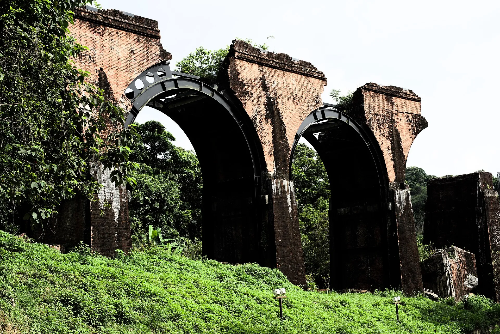
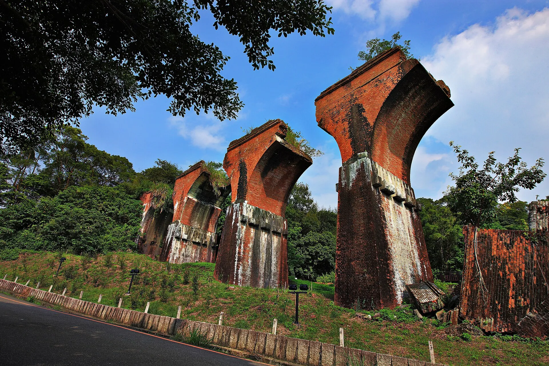
Remains of Longteng Bridge (龍騰斷橋/魚藤坪斷橋)
Miaoli County Road 49, 367 Sanyi Township, Miaoli County, Taiwan
For official tourism information see Taiwan Tourism Administration (official tourism portal) . Map pins, reviews and business information change over time; follow road signs and on-site guidance for parking and walking routes.
Read next
- Visitor guide First Visit to Longteng Bridge: What to See and How Long to Stay A first-timer's guide to the main viewing area, visit duration, admission, photography, and how the rail bike differs from the bridge ruins.
- Visitor services Longteng Bridge Visitor Facilities: Toilets, Parking, Food and Supplies Plan for toilets, parking, food, stays, convenience stores, fuel, EV charging, medical help, mobile reception and accessible family facilities along the Old Mountain Line.