Why Is Yutengping Called Longteng? Place Names and Local Legends
One location carries two names: Longteng on many maps and Yutengping in older records. The shift is historical, while local stories reveal how people remember their valley.

Earlier place name
Yutengping
Present village name
Longteng Village
Name-change context
After the 1935 earthquake
Nearby mountain
Guandaoshan
What is yuteng?
A climbing plant whose roots contain substances traditionally used to stun fish.
An auspicious new name
Longteng evokes the phrase about dragons soaring and tigers leaping.
Two names coexist
Longteng is common in administration and tourism; Yutengping remains in historic and railway references.
One place, two names
Tourism information commonly calls this attraction Longteng Bridge, whereas older maps, railway records and heritage documentation refer to Yutengping Bridge. Both describe the same crossing and locality in different naming periods.
The formal heritage designation is Yutengping Broken Bridge, while Longteng Broken Bridge is widely used by tourists. Learning where both names came from reveals a concise history of this part of Miaoli.
Yutengping: a name linked to a plant
One widely repeated local explanation connects the name Yutengping with a climbing plant called yuteng, or fish-poison vine. Compounds in its roots can stun fish, and people historically used related plants to catch fish and shrimp in streams. According to the story, the vine grew abundantly around the valley, giving the settlement and stream their name.
This is a local explanation, not a documented certainty. Many Taiwanese place names refer to plants, landforms or livelihoods, so the interpretation fits a broader naming pattern; however, no definitive public record establishes precisely when or how this place received the name.
Yutengping Creek flows below the bridge. The creek, valley and bridge thus share a closely connected naming history.
Why did Longteng replace Yutengping?
After the 1935 Guandaoshan earthquake, local usage increasingly shifted toward Longteng. Two themes appear in local accounts:
- Seeking an auspicious name: The vine’s association with poisoning fish and the image of entanglement were reportedly considered unlucky. The new name draws on a phrase suggesting a soaring dragon and leaping tiger, symbolizing renewed prospects.
- Rebuilding and administrative changes: Post-earthquake reconstruction and changes to local administrative organization provide a broader context for renaming.
Again, the precise cause-and-effect sequence is not fully documented in available official records. These are useful as community memories of disaster and a desire for renewal, not as conclusively established explanations.
Today both words remain useful: Longteng is prevalent in administration and tourism, while Yutengping appears in historic and railway materials. Neither name is inherently incorrect.
Guandaoshan: the mountain and the earthquake
The name Guandaoshan is commonly explained through the mountain’s resemblance to a guandao, a traditional bladed polearm. The 1935 earthquake is associated with an epicentral area near this mountain, hence “Guandaoshan earthquake”; it is also called the Hsinchu–Taichung earthquake for the historical regions it affected.
Earthquake-related commemorative and interpretive facilities in the area recall the disaster. In the Longteng Bridge story, Guandaoshan is more than a distant landmark—it represents the seismic event that changed the original bridge’s fate.
The broken bridge in local memory
The site’s meaning has continued to change since the renaming:
- Transport memory: Older generations remember the mountain railway and the replacement route after the quake.
- Photography landmark: The brick arches create a dramatic valley composition, attracting visitors and wedding photographers; weekend crowds and tripods have become part of its contemporary scene.
- Tourism renewal: Since the late 2010s, some sections of the old railway have reopened as the rail bike experience, reconnecting the disused track with travel itineraries.
These are not legends but observable changes: the same structure has been transport infrastructure, a disaster site and a protected tourist landmark.
Separating legend from fact
Overstated stories do not help visitors. Our approach is:
| Type of information | Example | How we present it |
|---|---|---|
| Documented history or engineering | Earthquake damage and the replacement iron bridge | As an established fact |
| Widely repeated local explanation | Fish-poison vine and the older name | Clearly labeled as a local account |
| Time-sensitive information | Tickets, departures, opening | Linked to current official sources |
| Unverifiable anecdotes | Tales about unidentified individuals | Not presented as fact |
A reliable heritage guide should help readers distinguish evidence from storytelling. Legends can be compelling without masquerading as documented history.
Reading the names on site
- Look at the brick bridge and remember its formal name: Yutengping Broken Bridge.
- Consider Yutengping Creek beneath it, tied to the earlier place name.
- Look toward Guandaoshan, associated with the 1935 earthquake.
- Think about Longteng Village and the community’s hopes embodied in a changed name.
For engineering and historical context, read the bridge history and earthquake science and visitor responsibility.
Explore the location from different angles
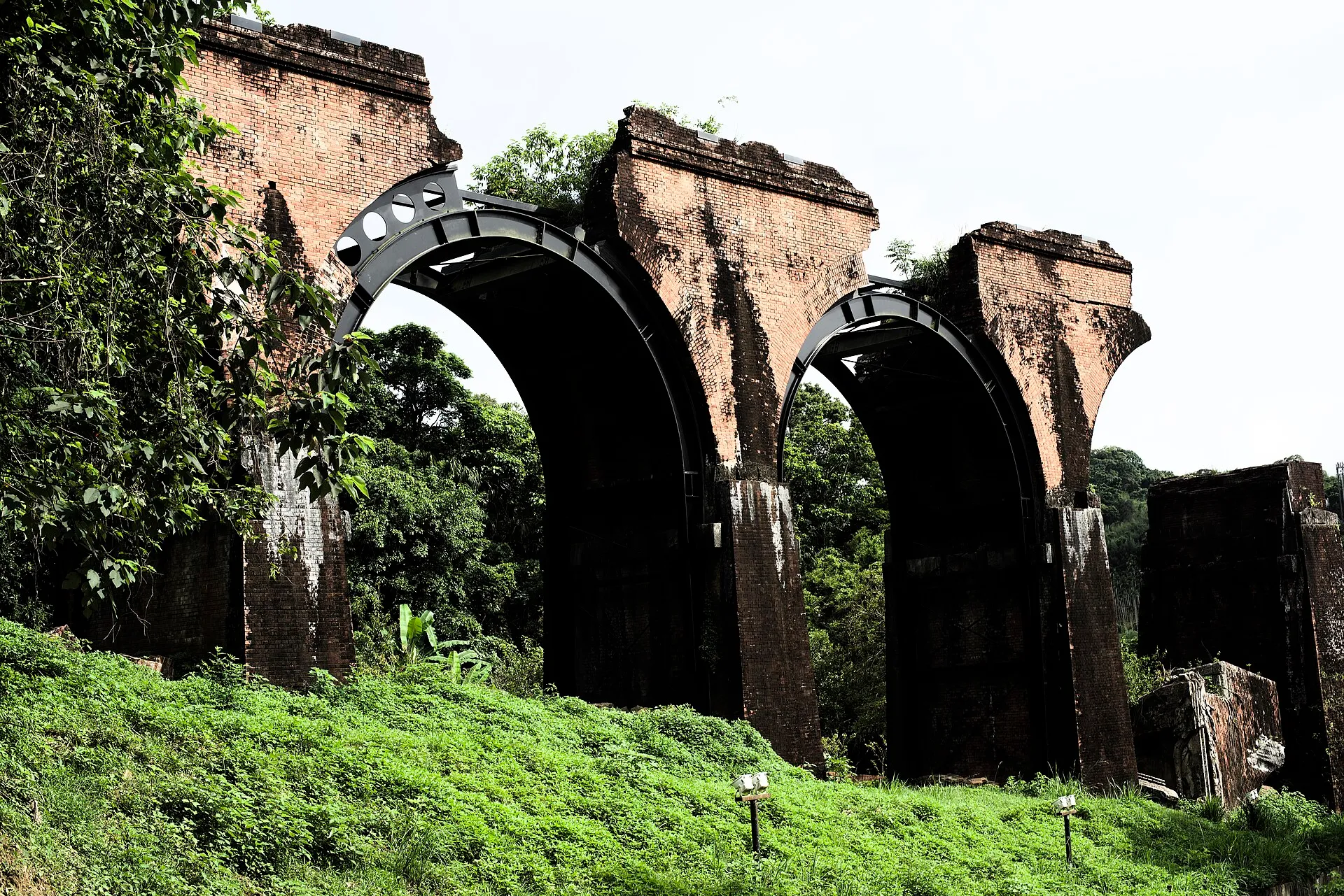
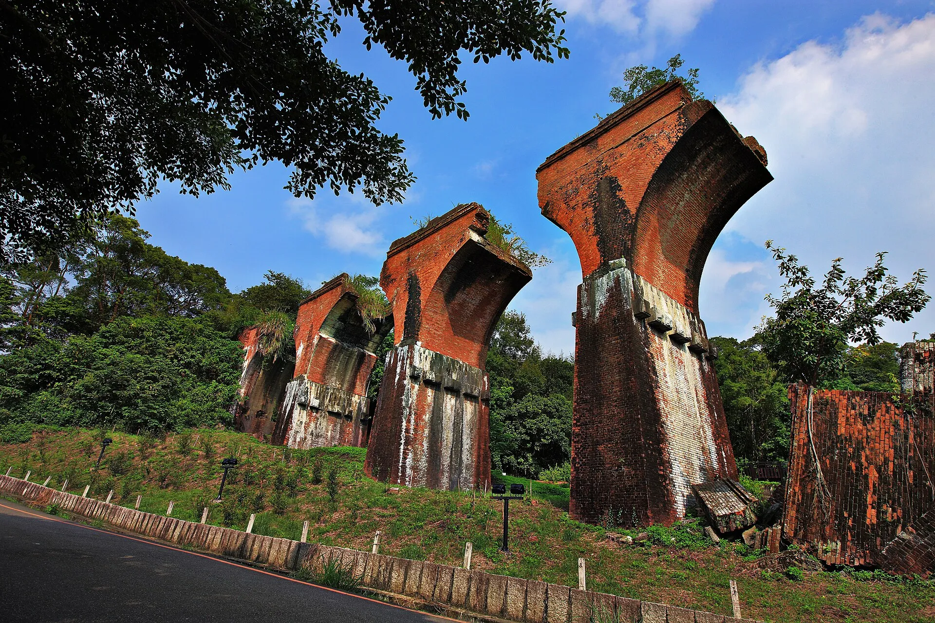
Plan your visit with Google Maps
Remains of Longteng Bridge (龍騰斷橋/魚藤坪斷橋)
Miaoli County Road 49, 367 Sanyi Township, Miaoli County, Taiwan
For official tourism information see Taiwan Tourism Administration (official tourism portal) . Map pins, reviews and business information change over time; follow road signs and on-site guidance for parking and walking routes.
Read next
- Historical background History of Yutengping Broken Bridge: Earthquakes and a Red-Brick Railway Trace the bridge from its 1907 completion through the 1935 disaster, replacement iron bridge and present-day heritage status.
- Science and responsibility Why Did Longteng Bridge Break? Earthquake Engineering and Visitor Responsibility Understand how brick arches failed in the 1935 earthquake and why protecting the remains and their wildlife habitats matters.
- Yutengping Iron Bridge Yutengping Broken Bridge and Yutengping Iron Bridge Are Not the Same Compare the construction dates, materials, positions and rail bike views of two often-confused bridges.